Hiking Day Three. Route 302 to Applebrook B&B on Route 115A in Jefferson
Route 302, Cherry Mountain Road, Cherry Mountain Trail, Owls Head Trail, Route 115, Slide Brook Trail, Presidential Range Trail, Ice Ramparts Trail, Colonel Whipple Trail, Whipple Road, and Route 115A
19.1 miles with around 2400 feet of elevation gain
We left the next morning right after we quickly ate a bit of food from the Lodge's free breakfast area (standard motel-style bread/waffle iron/yogurt breakfast fare) and walked down the road a few tenths of a mile to the store close to the road which houses the Cog Railway. We bought our food for the day and continued down Route 302 to Cherry Mountain Road, Alex leading the way.


We turned right on Cherry Mountain Road and walked the few miles up the hill to the trailhead with Cherry Mountain Trail.
A few notes about the campsites on Cherry Mountain Road -- first, they looked like they had all been full the night before. Also, they are free (which is nice) and first come first served. Also also, DO NOT attempt to stealth camp if the sites are full, for that is illegal and we saw a ranger patrolling the area as we walked up the road fairly early in the morning. Finally, there are nine campsites, not eight as is written in the data/guidebook. The ninth campsite is all the way up the hill on the left and immediately before the Cherry Mountain Trail trailhead.

Historic cabin on the way up, before the first campsite.


Here's a sample of a campsite -- they are plenty big enough for more than one good-sized tent.

Up the road, which was never steep and often flat-ish...

Beautiful pond along the way...


One of many frogs...


The trailhead is set into the woods a bit, right after the ninth campsite.

We donned DEET at this point since the bugs were coming out and we didn't want to be tortured more than we had to be...also, the tall grass on this trail meant tick possibilities.
For the most part up Mt. Cherry and Mt. Martha, the trail looked like this. Sometimes it was steeper, but the grassy details more or less looked the same...
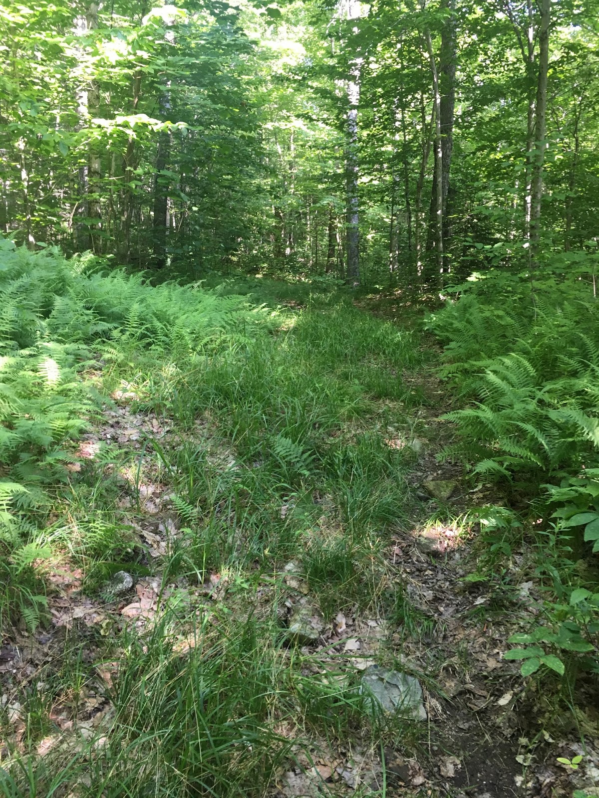
This was the worst part of our entire Cohos Trail hike, according to Sage. Namely because it was the buggiest part of our entire thru-hike (I thought our Kilkenny Ridge Trail experience was worse, but we'll get to that later). This trail is never steep, but the heat and the nonstop bugs really got to us. The DEET seemed to do nothing whatsoever. This section seemed to drag on and on, so we were very happy when we got to the top of the ridge and the trail started to look more like a maintained path.

The intersection with Owls Head Trail (on which we continued)...

The trail became a lot "cleaner"...

From the intersection, it was just a quick couple tenths of a mile up to the summit. The views on Mt. Martha are wonderful, but unfortunately there was zero reprieve from the bugs so we didn't linger.


Summit marker...

Moving on toward Owls Head (not the 4K Owls Head)...

The bit of trail between Mt. Martha and Owls Head is mainly downhill, well-maintained, and easy to follow. Unfortunately, it was still incredibly hot and buggy...

Up the little scrambles to the summit of Owls Head...


The views from Owls Head were MUCH nicer than the view from Mt. Martha and...there was a nice breeze that cooled us off and kept the bugs away! We sat up here for a while to soak in the views and enjoy our lunch.

 |
| Mt. Martha in the background |


After we had sated ourselves, we descended Owls Head. The going was a bit steep, but the trail is well-maintained.


On the way down from Owls Head, not far from the end of the trail, we saw our very first indication that we were on the Cohos Trail.


Before this point, there is currently NO COHOS SIGNAGE OR BLAZES. Apparently, there are legal issues with marking the trail in the White Mountain areas and in the Mt. Washington Hotel areas (and I guess along Route 302?). I have heard there are negotiations and talks underway to hopefully put blazes and signs along those sections, so maybe this will change. From this point all the way to Canada though, the trail is often marked with Cohos Trail signs and/or yellow blazes.
We reached Route 115, crossed it, and walked a few dozen feet to the entrance with Slide Brook Trail.


The entrance to Slide Brook Trail looks like this...

The path takes you through thick vegetation. The markers can be difficult to see since the vegetation often grows in front of them, over them, and around them -- keep your eyes sharp and you'll see them.


Sage kept finding blueberries and raspberries in the thick of all the vegetation. All I could see was chest-high vegetation to plow through, but she kept finding berries. :) I like that about her -- she always finds wonderful things in the midst of less-than-wonderful things.
A bit of a reprieve from the tall vegetation...

Sage and her berries...

More tall vegetation...

Alex is in the lead up there, looking for and finding the yellow-tipped trail markers...

Into the woods, where the trail looks like trail!


Past beaver activity...


Bog bridges...


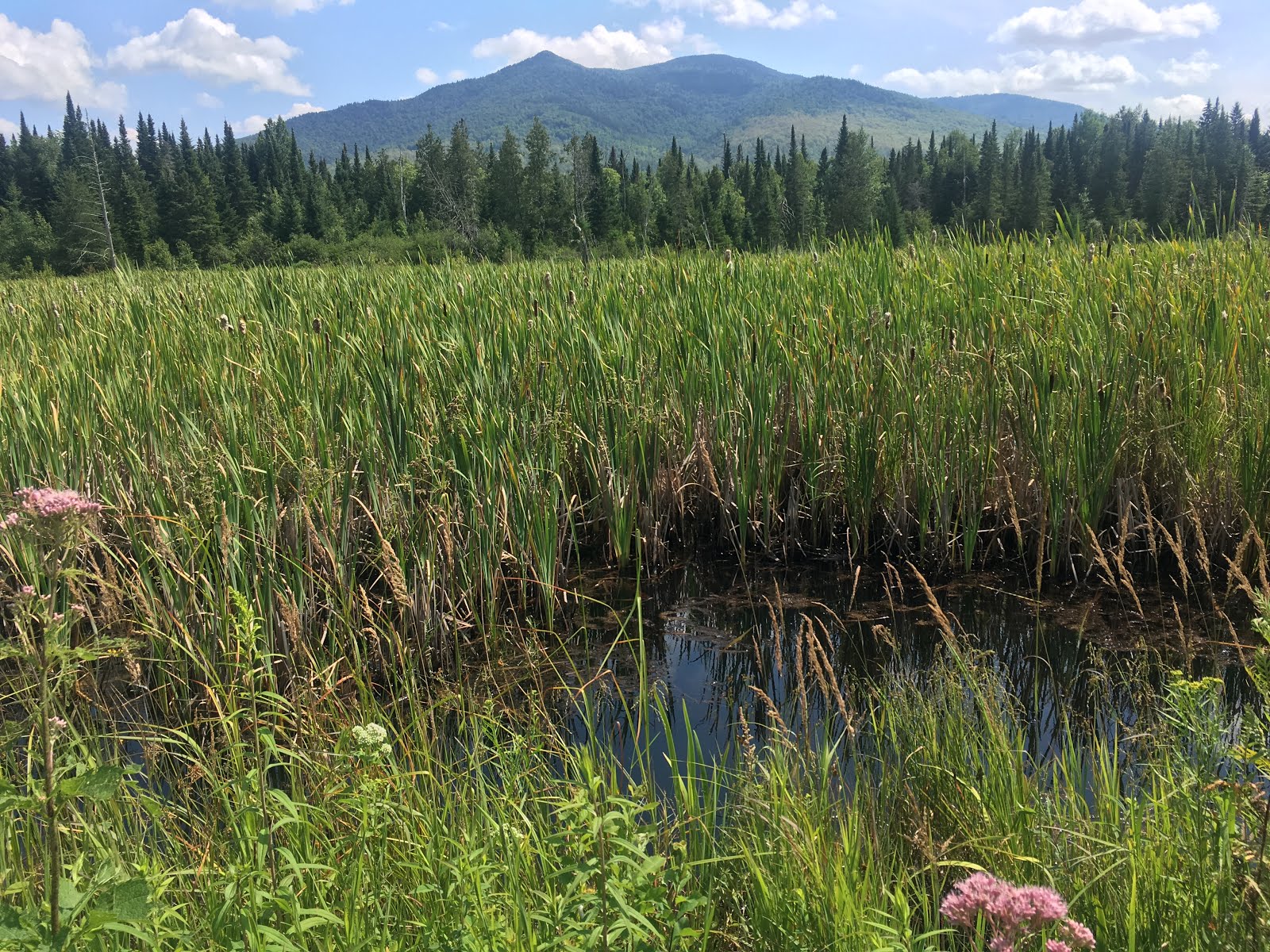
Presidential Rail Trail!
The Presidential Rail Trail was a joy to walk. The width and easy terrain was a welcome relief from fighting through tall vegetation, the wild flowers were gorgeous, and the views were spectacular. The trail takes you into the Pondicherry Wildlife Refuge, which is a truly lovely place to visit.


We reached the viewing platform and took a short water break.


After the viewing platform, you turn right and hike along the railroad tracks for a short while...


Take a right at Ice Ramparts Trail and head away from the tracks and back toward the water...


The Ice Ramparts Trail will take you to Col. Whipple Trail...

Col. Whipple is a nice walk along bog bridges and vegetation; the footpath is clear and there is no wading through chest-high weeds.

Unfortunately, I don't have more than one photo of the Col. Whipple Trail since, not long after we started hiking, it, thunder sounded. Within ten minutes of us hearing the first far-off peals, the storm came overhead and dumped tons of water and threw lightning bolts all around us. We threw on our pack covers five seconds before the skies opened, then we moved quickly along the path, trying not to linger in deep puddles (difficult!). Since we weren't far from the road, and since we were heading toward a B&B for our first rest day, we allowed ourselves to get drenched. It felt quite nice, actually, since the day had been hot. We covered the remaining miles of the Col. Whipple Trail is very short order and arrived at Whipple Road right when the downpour reduced itself to a drizzle.

The girls check the health of their cell phones, which they had hastily stashed in safe places right after throwing on their pack covers...

Happily drenched and on the road...

From here it was a road walk to the B&B. The part of the storm that had raged over us was only a few miles ahead of us, and we could hear a second storm coming from behind us. We therefore walked the road with cautious eyes on the sky.


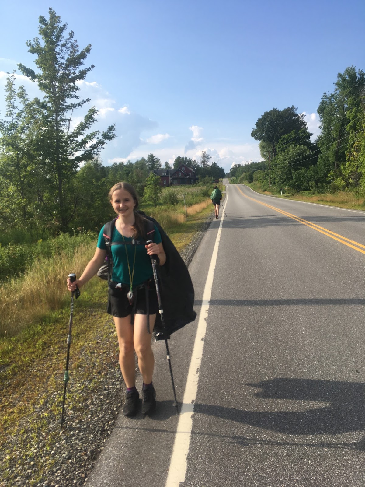
We turned onto 115A and seemed to move away from the newer, incoming storm...


Up, up 115A toward Applebrook B&B...


There it is, in the distance to the left! Alex is happy and decided to walk backward for a while...
We arrived at Applebrook B&B for what was to be a heavenly stay. I'll write a short post with lots of photos of Applebrook B&B and our first planned rest day tomorrow. For now, here's a photo of one of our beds, which we were happy to fall into after soapy showers.

This is a good example of how different people can hike the same trails on different days and have very different impressions. I thought Mt. Cherry Trail was nice. I also thought that Col. Whipple Trail was definitely the worst part of the whole Cohos Trail. Also, although the first part of Slide Brook Trail was pretty and smelled nice, after I hiked it I had about a dozen ticks on each leg.
ReplyDeleteMt. Cherry Trail was a hot and humid bugfest when we did it, which is what we remember most about that trail. Col. Whipple Trail was well-blazed, easy to follow, and not a big deal. I think much of our individual impressions comes from the weather of the day.
DeleteWe had no ticks at all on our hike at any time; we were careful to put tick repellent on our pants, legs, and socks, though. We checked constantly, and not one of us ever fell victim.